Erf 1058, Whites Road, Hoekwil (Wilderness Heights) Draft Basic Assessment Report

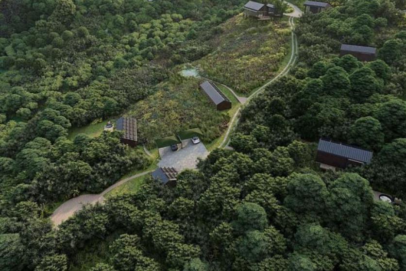
The Basic Assessment Application is for a proposed low density residential and tourism development on Erf 1058 Hoekwil (Wilderness Heights), Wilderness in the George Municipal Area of the Western Cape. The proposed development will consist of 730m2 of building structures including a main house, three accommodation units, and associated infrastructure, as well as 1051m2 of landscaped areas (roads, parking, pool, deck areas, etc) on the 3.0108ha property. The GPS coordinates to the property is 33°59’20.00"S, 22°35’55.89”E.

Erf 1058 Hoekwil
DRAFT BAR ERF 1058 HOEKWIL 16.05.2024.pdf
Appendix A1 Location Maps.pdf
Appendix A2 Coastal Management Lines.pdf
Appendix B1 Site Development Plan.pdf
Appendix B2 Environmental Sensitivity Mapping.pdf
Appendix C Site Photographs.pdf
Appendix D Biodiversity Overlay Maps.pdf
Appendix E1 Final comment from HWC.pdf
Appendix E2 CapeNature Comments.pdf
Appendix E3 BOCMA Comments.pdf
Appendix E5 Forestry Comments.pdf
Appendix E6 Road Access Approval.pdf
Appendix E7 Comments from DoA.pdf
Appendix E9 Department of Health.pdf
Appendix E14 CMU Comments.pdf
Appendix E16 Confirmation of Water Services.pdf
Appendix E17 District Municipality.pdf
Appendix F Comments and Response Report PUBLIC.pdf
Appendix G1 Planning Statement.pdf
Appendix G2 Geotechnical Report.pdf
Appendix G3 Biodiversity Plants Animals Assessment.pdf
Appendix G4 Freshwater Compliance Statement.pdf
Appendix G5 Heritage Statement.pdf
Appendix G6 Visual Impact Assessment Report.pdf
Appendix G7 Engineering Services Report.pdf
Appendix G8 Agricultural Compliance Statement.pdf
Appendix H Draft EMPr 0.pdf
Appendix I Screening Tool Report SSVR 0.pdf
Appendix J Impact Assessement Table 0.pdf
Appendix K Need Desirability 2.pdf
Appendix L Alien Clearing Plan 0.pdf
End Date

Public participation survey