Pre-Application Basic Assessment Report - Proposed Development on Erf RE/1627, Sedgefield, Knysna Municipality, Western Cape
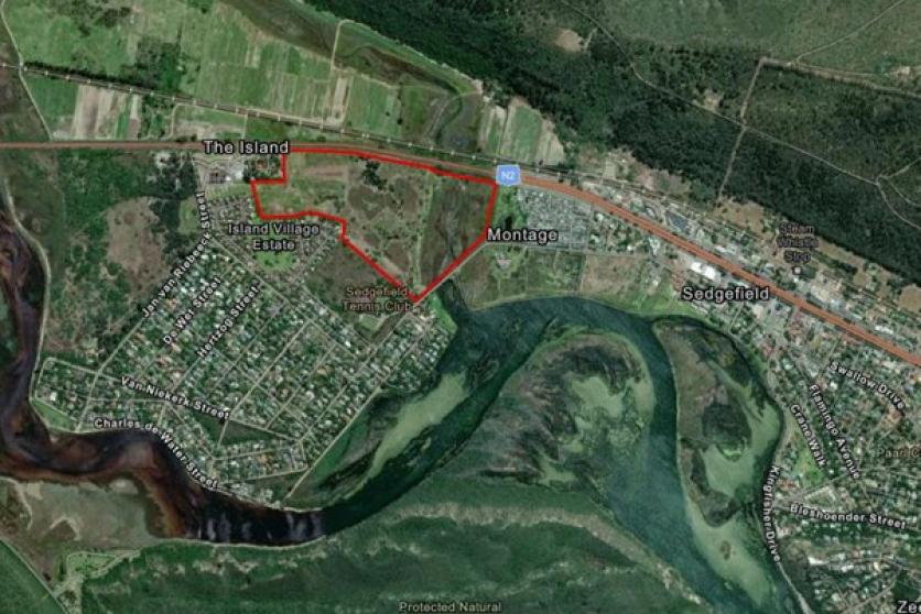
The property known as Remainder of Erf 1627, Sedgefield is situated on The Island in the coastal town of Sedgefield, within the Knysna Local Municipality, Western Cape. The site is located immediately west of the Sedgefield central area, bordered by the Swartvlei Estuary system to the north and surrounded by a mosaic of residential and natural areas. The site falls within proximity to the Swartvlei, Hoekraal River, and Myoli Beach, with the Protected Natural Dune Fynbos area lying to the south. Access is primarily via local roads that connect to the N2 national route situated to the east of the property.
The entire property, like most of the low-lying areas in Sedgefield, is located within the Estuarine Functional Zone (EFZ; below the 5m contour) of Swartvlei Estuary. According to Dabrowski (2021), 11.4 ha of the 26.6 ha property lies between the 2.5m and the 3m amsl contours, while 3.7 ha is above the 3m amsl contour. This represents 43% and 14 % of the property, totaling 57 % above the 2.5m amsl contour.
The undeveloped property has been used for agricultural purposes as early as 1936 based on aerial imagery, and was cleared of vegetation. Thus the receiving environment is currently mostly transformed and with successive invasions by Invasive Alien Species has caused degradation of the fynbos ecosystem.
Based on site surveying the study area contains plant species representative of Dune Fynbos and Wetland ecosystems.
The site is currently vacant and the vegetation of the site is complex and comprised of multiple distinct types which are influenced by aquatic features, historical agriculture, and alien invasion. The latter was dominated by Port Jackson (Acacia saligna) 40%, Myrtle (Leptospermum laevigatum) 30%, Rooikrans (Acacia cyclops) 20% and Inkberry (Cestrum laevigatum) 10% (Approximate proportions provided by landowner). The site has recently been cleared of extensive stands of alien vegetation and very little remains thanks to the efforts of the landowner.
RE/1627 is situated approximately 137 meters from the Garden Route National Park of which SANParks are the custodians.
Approximately 90% of RE/1627 falls within a CBA Aquatic Area and the site is classified as a greenfield site.