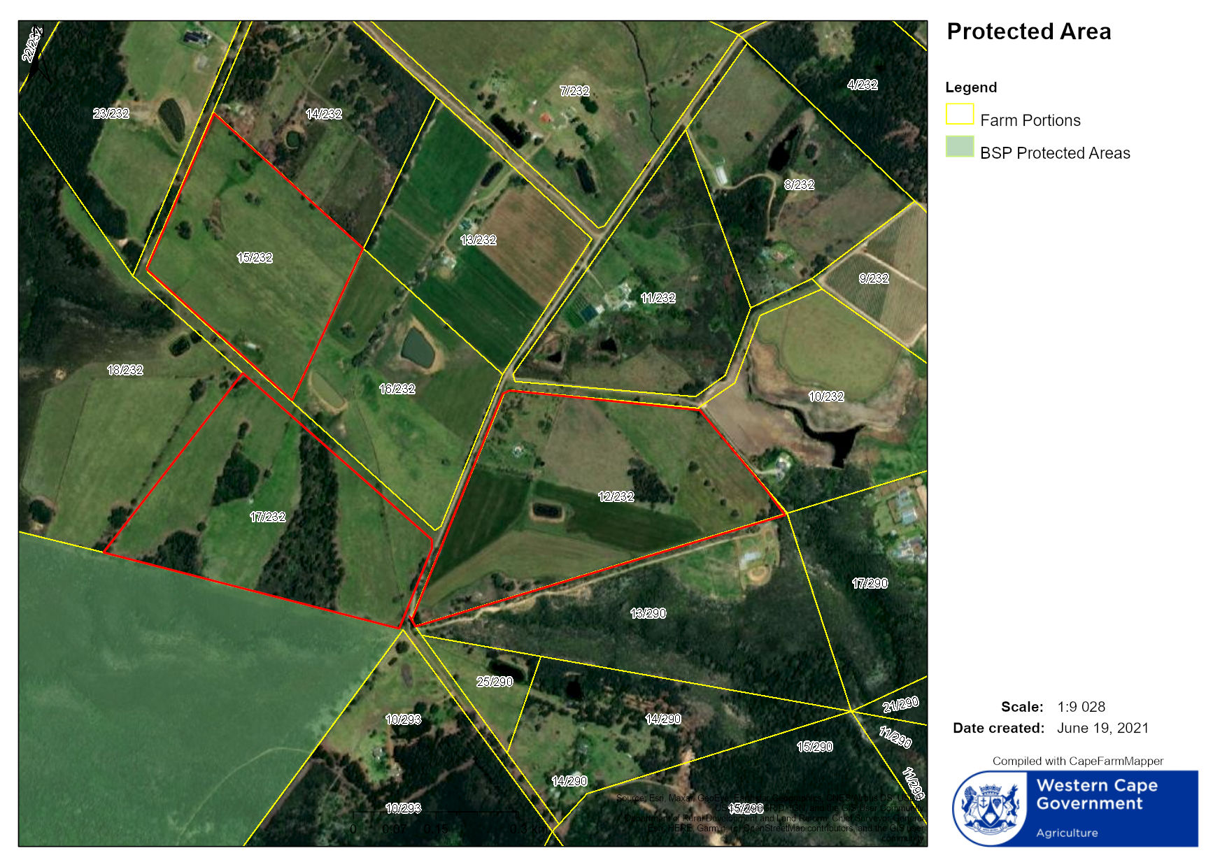
S24G for Portion 17 of the Farm Redford 232
Rectification of Unlawful Commencement of clearance of indigenous vegetation and the development of dam within a non-perennial watercourse on Portion 17 of the farm Redford 232, Palmiet Drift Rd, The Crags, Bitou, Western Cape
Section 24G Application Form for the consequences of unlawful commencement of listed activity/ies in terms of the:
• National Environmental Management Act, 1998 (Act No. 107 of 1998), (“NEMA”);
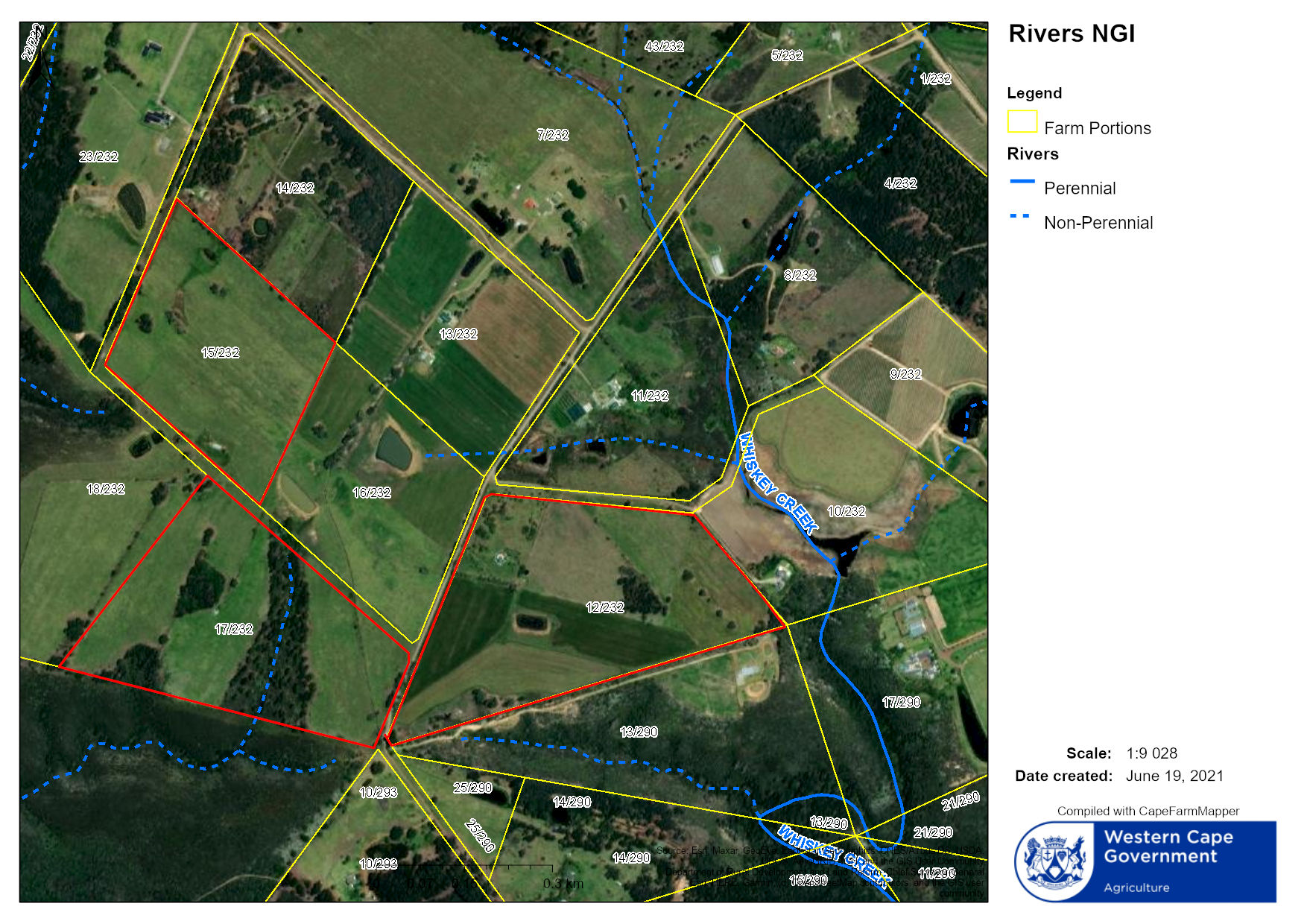
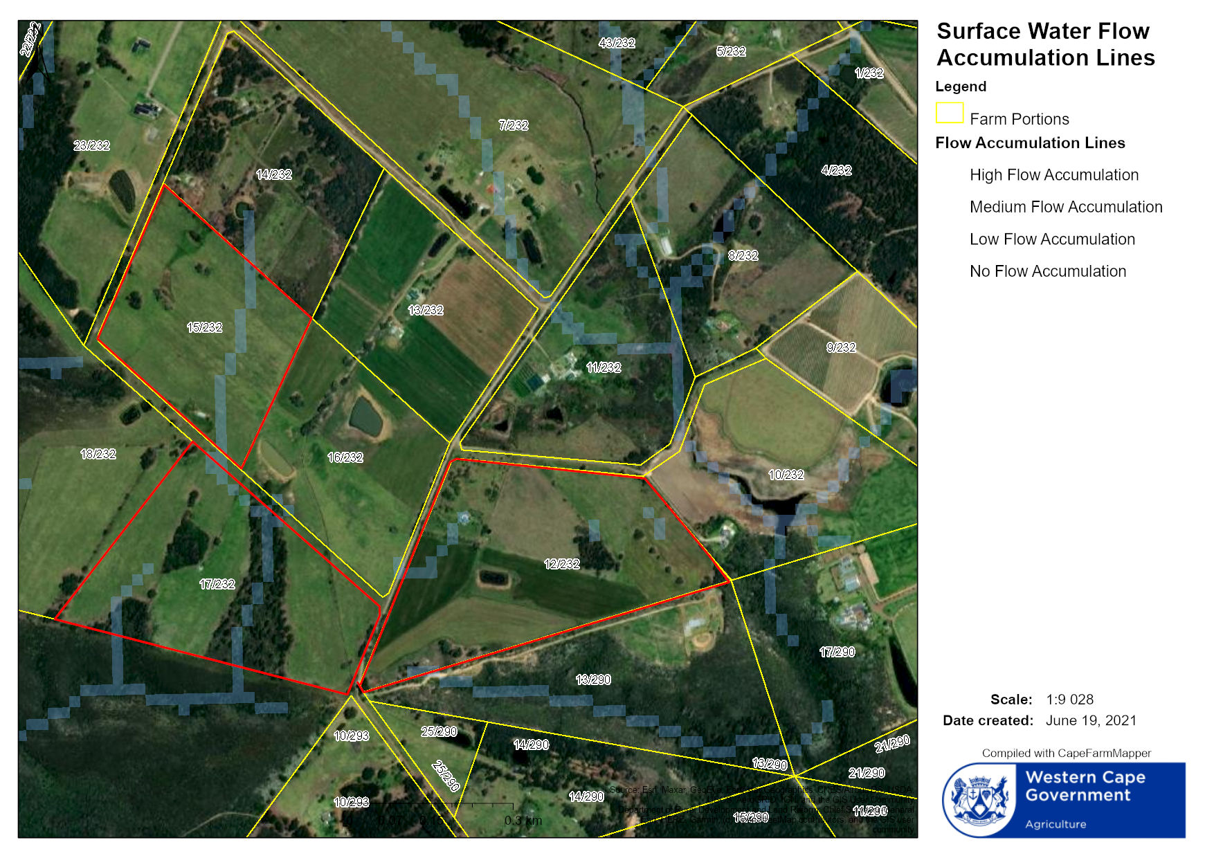
Aquatic Specialist Assessment for a Section 24G and Water Use License Application at 17 / 232 Redford Farm
Terrestrial Biodiversity Report Environmental Sensitivity Report Farm Redford No 232 Portion 17 Redford Farms, The Crags Bitou Municipal Area.
Bernardskloof Dam is a proposed new dam on Portion 17 of the farm Redford in The Crags area near Kurland in the Bitou Local Municipality in the Western Cape.
This report advises the owner on the engineering and technical requirements for the project, in terms of the technical scope of works, regulatory requirements and recommendations on further investigations and design.
The dam is to be a 17 m high earthfill dam with storage capacity of 73 000 m³. Water will be fed from an irrigation canal. The natural catchment is on 0,2 km².
Based on its size the dam will be registered as a dam with a safety risk in terms of the National Water Act and classified as a Category II dam in terms of the Dam Safety Regulations.
An Approved Professional Person will have to be employed to oversee the design and construction of the dam. The feasibility design concluded that an uncontrolled bywash spillway should be constructed on the left flank. A 150 mm diam. bottom outlet pipe should be installed for emergency draw-down and environmental releases (if required.) No further studies are required for the feasibility design.
A geotechnical survey of the site and material should be conducted as part of the detail design phases.
A Survey for the proposed Dam.
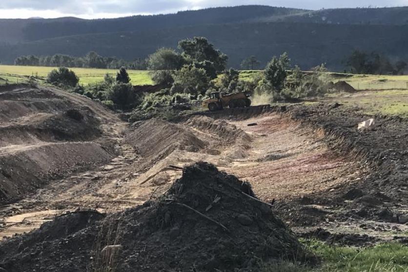
Confluent Environmental were appointed by the land-owner to conduct the Aquatic Specialist study required for the Section 24g and water use authorisation process. During the initial site visit, it was clear that in its current state, the excavated dam area represents a significant threat to the water resource downstream in terms of erosion and sedimentation. This report provides the following information:
- Erosion risk presented by the unlawful activity;
- Extent of current sedimentation;
- Justification for immediate implementation of erosion control measures, and
- Recommended mitigation measures.
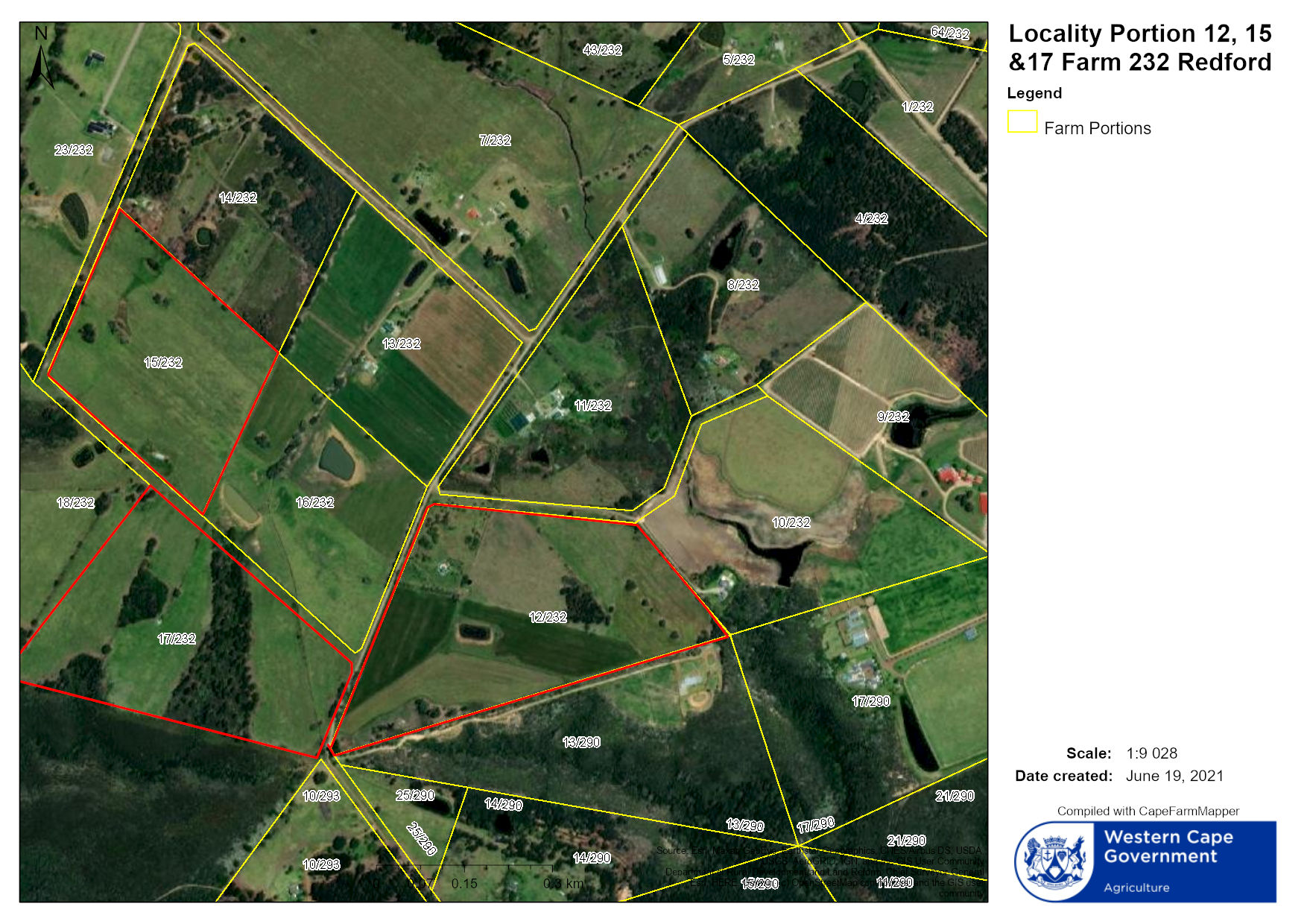
Balderja (Pty) Ltd is in the process of developing nut orchards and various crops on Portions 12, 15, 16 of the Farm Redford 232, hereafter also referred to as the site. Water for the project will be sourced from groundwater through abstraction from boreholes and as part of the environmental authorisations, the water use needs to be licensed. Balderja (Pty) Ltd therefore appointed DHS Groundwater to conduct a geohydrological assessment as part of the Water Use License Application (WULA)
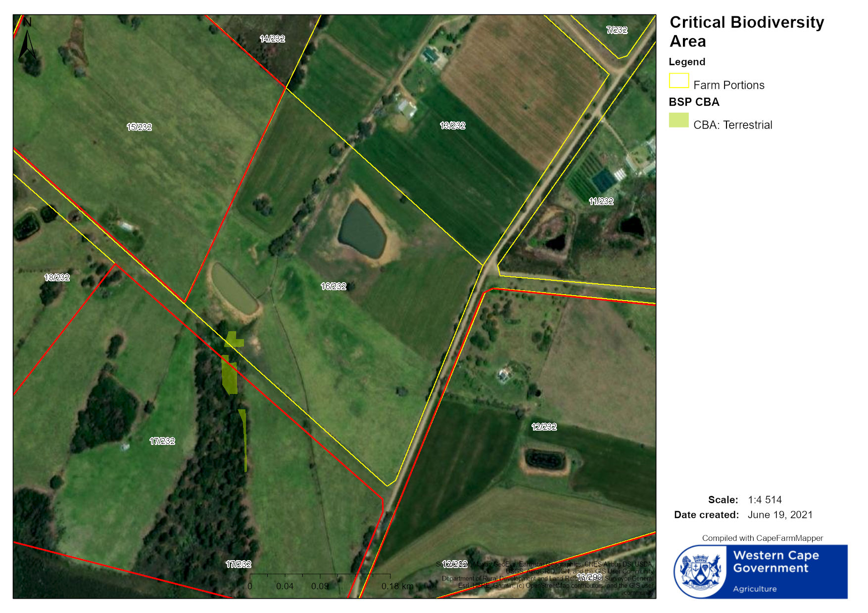
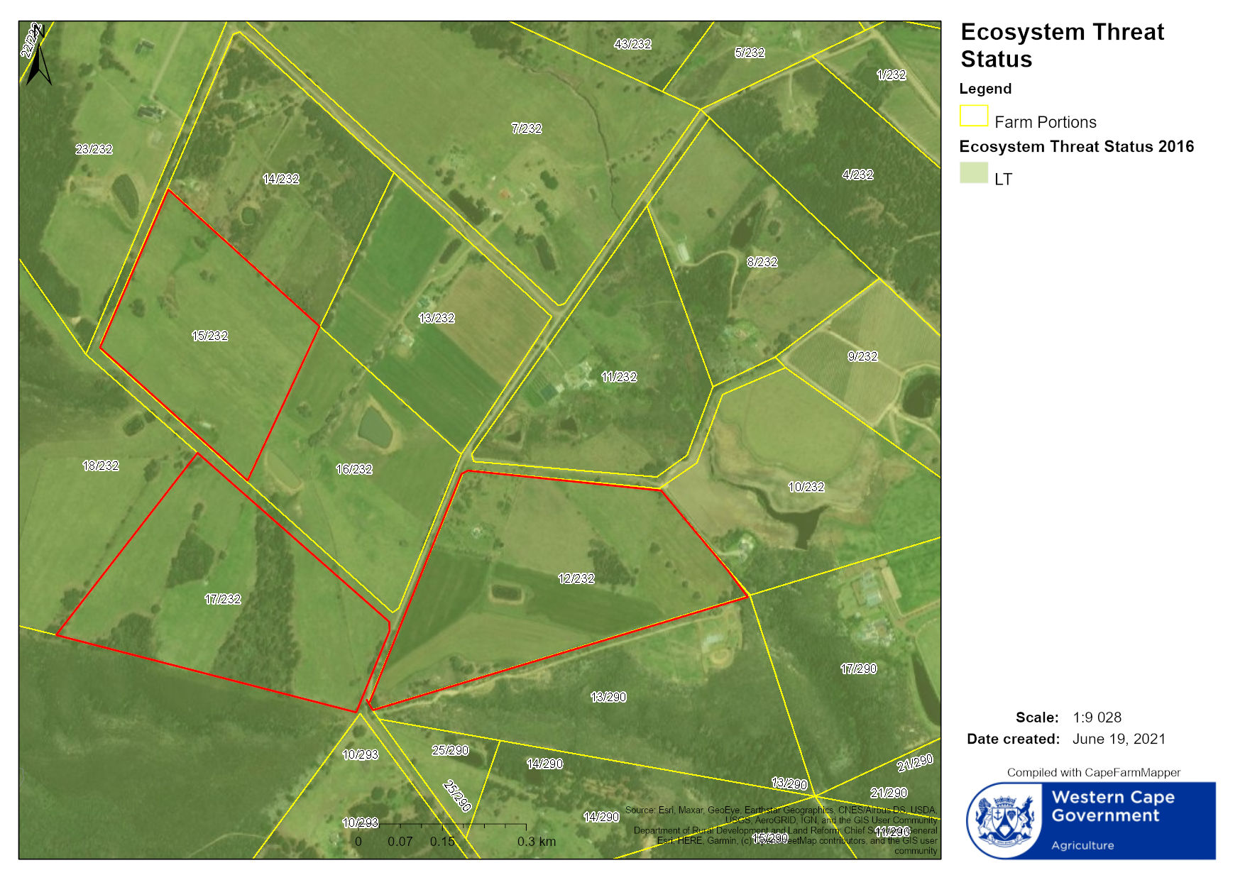
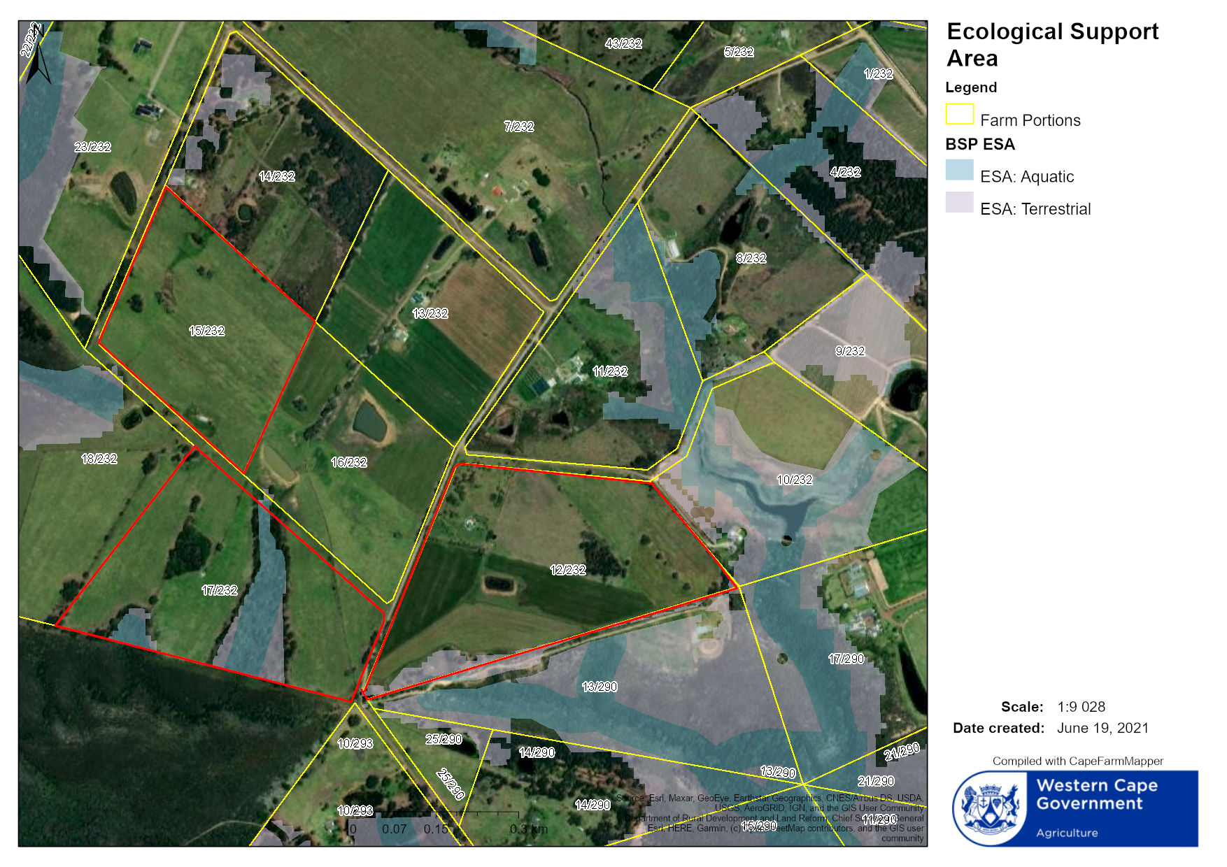
CapeFarmMapper is a product of the Western Cape Department of Agriculture. This online mapping tool is designed to assist with spatial information queries and decision making in the fields of agriculture and environmental management.