Application for Environmental Authorisation - Proposed Expansion of development footprint on Erf 631, Sea Vista, St Francis Bay, Kouga Local Municipality

A residential house is in place on Erf 631 located at 9 Shore Road, Sea Vista, St Francis Bay within ward 12 of the Kouga Local Municipality, Eastern Cape. Erf 631 is approximately 1549.9 m2 in extent and falls within the Kromme Estuarine Functional Zone. An existing house is in place on the Erf with a total existing floor area of 386m2; the owner is proposing to expand the development footprint on the Erf by approximately 267m2 (new garage, braai rooms, dwelling additions and balconies).

Approximate central coordinates of Erf 1220: 34° 8'34.19"S ; 24°49'52.15"E

In terms of National Wetland Map (NWM5) the site falls within the Kromme Estuarine Functional Zone. More than 5 cubic meters material will be removed / deposited for the proposed renovation. Expansion will fall within 100 meters of highwater mark of the Kromme estuary.
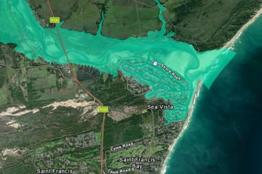
Erf 631 falls within Kromme Estuarine Functional Zone (National Wetland Map 5 – NWM5)
BID Erf 631 Final.pdf
Erf 631 Shore Road St Francis Bay Notice.pdf
End Date

Public participation survey