Draft Basic Assessment Report for Erf 1256, Sea Vista, St Francis Bay, Kouga Local Municipality
Eco Route Environmental Consultancy has been appointed as independent environmental practitioners by the proponent, Mr Rian Chalmers, to ensure the lawful construction of a Residential Dwelling on Erf 1256, St Francis Bay, Kouga Municipality in terms of the National Environmental Management Act (Act 107 of 1998).
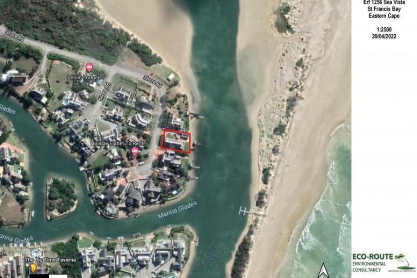
The proposed residential dwelling will be developed on Erf 1256 Sea Vista, a suburb of St Francis Bay, Eastern Cape (GPS coordinates: 34° 8'49.09"S|24°50'19.34"E).
Erf 1256 is zoned for Residential use. The property is 910m2 in extent and currently has an existing residential dwelling which is to be demolished in preparation for a new residential dwelling to be constructed.
The dwelling footprint will be 455m2, is located along the Marina Glades canal and falls within an Estuarine Functional Zone. The Estuarine Functional Zone (EFZ) is defined as the area in and around an estuary which includes the open water area, estuarine habitat (such as sand and mudflats, rock and plant communities), and the surrounding floodplain area, as defined by the area below the 5 m topographical contour (referenced from the indicative mean sea level).
The proposed residential development will entail the construction of a three-storey (lower ground, ground and first floor) house, associated decking and paving for vehicular access. The dwelling will occupy 50% of the site as opposed to the previous dwelling which occupied 30% of the property.