FINAL Basic Assessment Report - The Proposed Residential Development and Associated Infrastructure on a Portion of Erf 1180, Keurboomstrand, Plettenberg Bay - DEA&DP Ref: 16/3/3/1/D1/6/0024/26
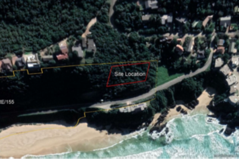
The site is located in Keurboomstrand, a resort town near Plettenberg Bay in the Western Cape, under the jurisdiction of the Bitou Municipality.
The subject site is undeveloped, containing no existing buildings, services or infrastructure (with one exception being some decommissioned water pipelines and associated infrastructure). It is offset from the nearest road (Main Street) by the 27m width of the adjoining public place (Erf 391), which shares its northern boundary. Its southern boundary is delineated by the 25m wide road servitude set out for Main Road 394, which is the main access and entrance road for the whole of the Keurboomstrand town.
The proposal is to develop 2x group dwelling units on the eastern portion (referred to as “Erf 1180”, previously Erf 155) of Erf 1236. Approximately 2000m² of the 5 000m² subject site is earmarked for development.